Project CONNEXSTERE (finished)
A global ecological restoration project off Leucate in Occitania as part of the EFGL project
ECOCEAN in partnership with the Centre de Recherche sur les Ecosystèmes Marins (CREM – UPVD/CNRS) and offers, through this ambitious pilot (called CONNEXSTERE), to enrich the understanding of the connection processes between juvenile and adult populations. The pilot seeks to study the possible flows of very young individuals (post-larvae, or juveniles of the year) between developed offshore areas, intermediate areas (artificial reefs of Leucate/Barcarès), and natural and artificial coastal nursery areas (including the lagoon of Salses-Leucate). ECOCEAN and its partners have always wished to carry out concrete actions and to obtain elements of answer aiming at supporting the development of marine biodiversity to accelerate the ecological recovery of the artificial environments. This project falls within this framework, it is in particular:
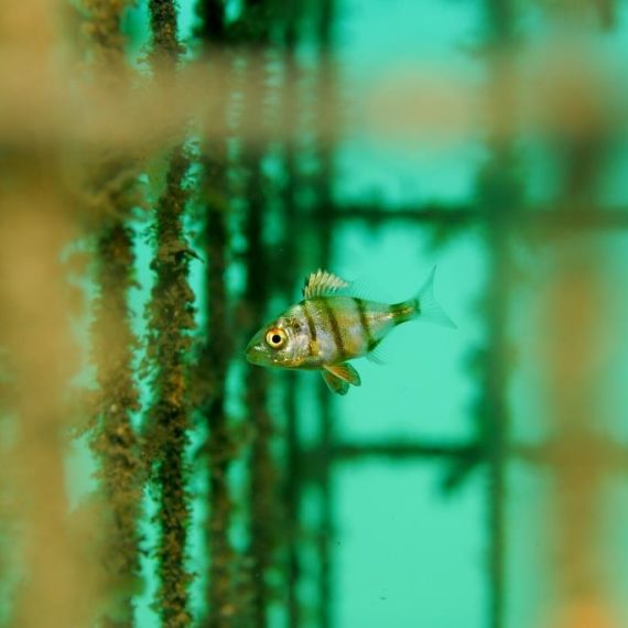
- To evaluate biodiversity (abundance and diversity of fish, fauna, and flora) on 3 sites from the open sea to the coast thanks to monitoring carried out by the scientific partner CEFREM-CREM-UPVD in natural areas and on artificial observation structures developed by Ecocean (Biohut),
- Observe possible relationships/connections between the open ocean, intermediate artificial reefs, and the coast for developed and natural areas,
- To recommend improvements in the eco-design of future offshore infrastructures (and in particular for the EFGL project).
This requires, in particular, the temporary installation of a buoy to observe the biodiversity present offshore.
This innovative pilot project, centered on a coherent territory from Cap Leucate to Cap Béar via the Salses-Leucate lagoon, should contribute to the understanding of ecological connections and evaluate the similarities in functioning (particularly in terms of the nursery function) between developed areas (offshore, on the coast and in the lagoon) and natural areas.
The managed areas are:
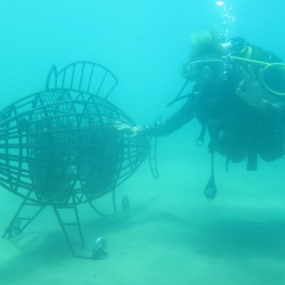
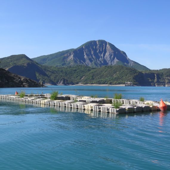
- A Biodiversity Observation Buoy (BOB), placed on the surface (and equipped with different types of Standardized Observation Units – Biohut), and located near the Lidar installed by the ENGIE company, at about 16.5 km from the coast. This observation buoy can be considered as a SADO buoy (Ocean Data Acquisition System).
The buoy, designed in partnership with PPI (Principal Power Inc.), was made of steel by the company Eiffage. This float is equipped with biodiversity modules (Biohut type quay, dikes, outfalls …) immersed between -4 and -8 meters, all made of recyclable and recycled materials (recycled oyster shells, wood, metal, …) which should allow standardized observations compared to other Biohut installed on the coast.
- A part of the existing artificial reefs of Leucate-Barcarès that will have been complexified using different Biohut models within the framework of the R&D project led by the CREM/CEFREM and which started in September 2018 (with a specific AOT application led by the University of Perpignan filed with the DDTM 66)
- The inside of the port of Leucate is engaged in the NAPPEX approach and which is already been equipped with Biohut since April 2018 (monitoring carried out by the CREM / CEFREM).
- The port of Argelès-Sur-Mer also committed to the NAPPEX approach and which is also been equipped with Biohut since November 2017 (monitoring carried out by the CREM / CEFREM).
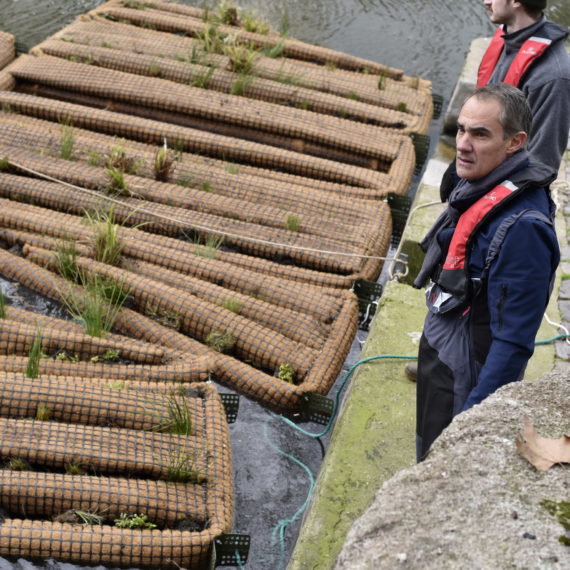
- Habitats dedicated to the CONNEXSTERE project (Biohut used as Standardized Observation Unit) were installed in the pond of Salses-Leucate and monitored in the framework of this project.
In addition to these developed areas, we offer to monitor the following natural areas, which are the limits of the “Gulf of Lion” system and correspond to the main rocky areas of the Gulf of Lion Natural Marine Park:
- To the north, the cliff of Leucate followed by the CREM within the framework of the project of complexification of the artificial reefs of Leucate/Barcarès (AAP Biodiversity AERMC)
- In the south, the rocky coast of the Côte Vermeille, and more precisely the stretch of coastline located between Cap Béar and Cerbère (Spanish border), has been monitored once a year within the framework of the CREM’s multi-annual monitoring program since 1994. This is a historical reference that allows us to know the degree of recruitment of a key species: the white seabream.